The Commonwealth Blue Charter is highlighting case studies from the Commonwealth and beyond, as part of a series to spotlight best practice successes and experiences.
Share your own case study with us
“Knowing real-time meteorological parameters and having access to suitable information has given us the opportunity to understand and improve maritime analyses in terms of maritime incidents.”
– Captain Franck Razafindraibe, Director of the National Maritime Information Fusion Centre (NMIFC), Madagascar
Summary
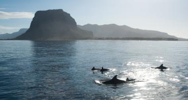
Coastal communities are exposed to an increase in the frequency and intensity of weather-related phenomena, such as sea surges, cyclones and flooding, due to climate change. The predictability of such events can be improved with knowledge gained from the acquisition and analysis of satellite-derived data on oceanic and atmospheric variables. However, the skills to perform such analyses and to harness their potential to benefit on-the-ground scenarios and mitigate risks are not widespread.
The C-RISe project has sought to improve this situation by offering training opportunities to coastal management practitioners in southern Africa through courses on how to acquire necessary open-access datasets (hosted by South Africa) and licence-free analytical software. Further training on how to apply such datasets and analytical skills to resolving specific challenges locally was delivered via the choice of 27 real-world cases from coastal settings in Mozambique and Madagascar.
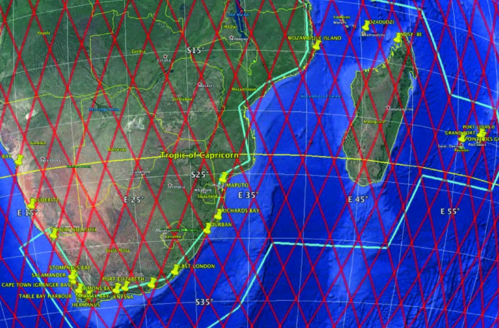
Image
Coverage of the C-RISe programme. The area within the light blue box gives the overall coverage of the programme, red lines represent ground tracks for Jason-series Earth Observation satellites, and yellow pins are tide gauge locations against which satellite data can be validated.
Applications covered a broad spectrum of topics linked to environmental protection, ecosystems management, fisheries management, health and safety at sea, as well as ongoing development and disaster prevention initiatives. Nine of these cases have been identified as having an impact, and findings from this work have been shared regionally, fostering further collaboration with Mauritius.
The challenges encountered during this project have largely pivoted on the age and computational capacity of available hardware in the region, as well as on the diversity of software versions still in use. Upgrading computational capacity to a common useable standard whilst also being limited by slow and intermittent connectivity to the internet – hampering access to data and training materials – has been a significant challenge.
The issue
The coastal populations of Southwest Indian Ocean nations are increasingly vulnerable to the effects of extreme weather events brought about by climate change. In particular, there are climate-sensitive, economically important coastal resources, such as port and aquaculture infrastructures, as well as ecologically important habitats that are exposed to the sea surges associated with evermore frequent and forceful cyclones.
Access to regional data on coastal risk factors (i.e., sea level change and wave and wind extremes) can support plans to protect coastal communities and safeguard economic activity. This information can also contribute to improving industrial and commercial competitiveness in the maritime sector (e.g., by improving maritime navigation security, or by monitoring seawater quality, pollution or toxic algal blooms in relation to coastal fisheries).
Image
Image
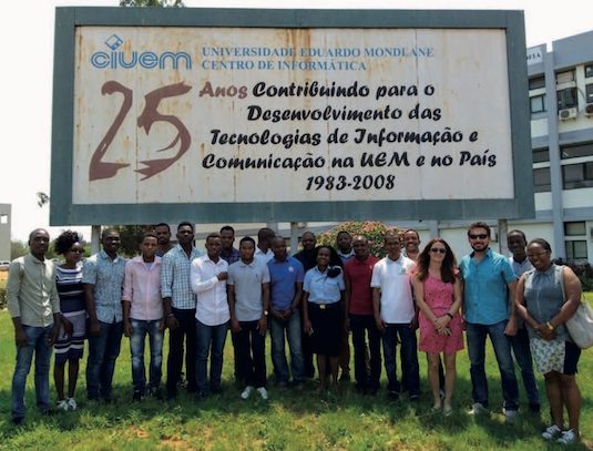
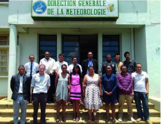
Training workshop participants in Madagascar and Mozambique
However, access and use of such data are hampered by limited technical capacity locally, with knock-on effects on the region’s ability to provide support for scientific decision-making regarding strategy development, governance and management of coastal areas and building resilience to coastal hazards.
The development of local capacity to access and use available data alongside other information sources is necessary to ensure a viable long-term service to manage coastal risks, mitigate potential losses and improve self-sufficiency.
The response
The Coastal Risk Information Service (C-RISe) was created – in partnership with Madagascar, Mauritius, Mozambique and South Africa – to facilitate access to satellite-derived data on sea levels, wind speeds and wave heights and to build local capacity for data analysis and application.
The goal was to enable stakeholders to improve socioeconomic resilience to coastal hazards associated with sea level changes such as floods, storm damage, wetland loss, habitat change, coastal erosion and saltwater intrusion.
C-RISe was funded by the UK Space Agency (UKSA) under the International Partnership Programme, whose aim is to deliver a sustainable, economic or societal benefit to developing countries and economies by identifying space solutions to solve their specific development challenges and so increase their capacity.
C-RISe’s objectives were threefold:
- Deliver a coastal risk information service, providing satellite-derived information about sea levels, winds and waves to support coastal vulnerability assessment and hazard management efforts.
- Apply and evaluate the C-RISe service through the application of its products to selected real-world scenarios that address local priorities.
- Build local capacity to use satellite data to provide scientific decision support for strategy development, governance and management of coastal areas to increase resilience to coastal hazards.
The C-RISe programme ran from 2016 to 2019, although its success generated further interest and additional funding from UKSA during its legacy period (March 2020-March 2021), enabling the acquisition and inclusion of higher resolution spatial data. A bid to expand the extent of the project was not successful; this option continues to be explored.
Partnerships and support
The C-RISe partnership comprised three contributors from the United Kingdom (Satellite Oceanographic Consultants Ltd, the National Oceanography Centre and Bilko Development Ltd) and ten international contributors from southern Africa: the Council for Scientific and Industrial Research, South Africa; the Mozambique Hydrographic Office; Universidade Eduardo Mondlane, Mozambique; the Madagascar Meteorological Office; the National Oceanographic Research Centre, Madagascar; the Institute of Fisheries and Marine Science within the University of Toliara, Madagascar; the National Maritime Information Fusion Centre, Madagascar; the University of Mauritius; WWF Madagascar Country Office; and Conservation International.
Support for the partnership came from the UKSA’s International Partnership Programme funded by the UK Government’s Global Challenges Research Fund, which supports challenge-led interdisciplinary research while strengthening capability for research, innovation and knowledge exchange.
Whilst funding for the initial three-year C-RISe programme ended in 2019, programme leaders have continued to investigate a range of potential funding options that centre on opportunities for C-RISe to work with other organisations, initiatives and donors in southern Africa, West Africa and the Caribbean. As of April 2021, a joint bid to continue work with partners in Madagascar is awaiting a final decision.
Results, accomplishments and outcomes
Following five introductory and training workshops using C-RISe data, African coastal and marine scientists selected 27 applications (16 in Madagascar, 9 in Mozambique, 2 in Mauritius) with which to embed the skills they learnt into their organisations for the long term. Applications covered a broad spectrum of topics linked to environmental protection, ecosystems management, fisheries management, better understanding of sea state and safety at sea. Specific examples include:
- Sea state information for improving maritime navigation security and safety for Madagascar
- Marine protected area management (Nosy Hara and Ambodivahibe) in Madagascar
- Impact of coastal climate change on mangroves on Madagascar’s west coast
- Pollution from rare earth metal mining in Madagascar
- Wave climatology for the Mozambique channel
- Analysis of regional variability in sea-level change in Mozambique’s coastal seas
- Effects of climate variability on semi-industrial shrimp catches in Maputo Bay, Mozambique
Results from all 27 cases were shared at regional workshops and conferences in Madagascar, Mauritius and Mozambique, allowing attendees to understand how data can be used whilst also fostering local cross-organisational partnerships. Nine applications have already been identified as having achieved significant impact by enhancing local capabilities, strengthening resilience towards natural hazards and improving management of protected areas, and all of them are available publicly via the C-RISe website.
The impact from these applications has included:
- Enabling law enforcement in cases of drug trafficking and illegal migration;
- Improved management of mangroves and reefs;
- Improved management of Marine Protected Areas, leading to their expansion.
A set of comprehensive training resources has also been made available online, which includes introductory materials, examples of applications for earth observation data, software installation instructions and capacity development tools.
Image
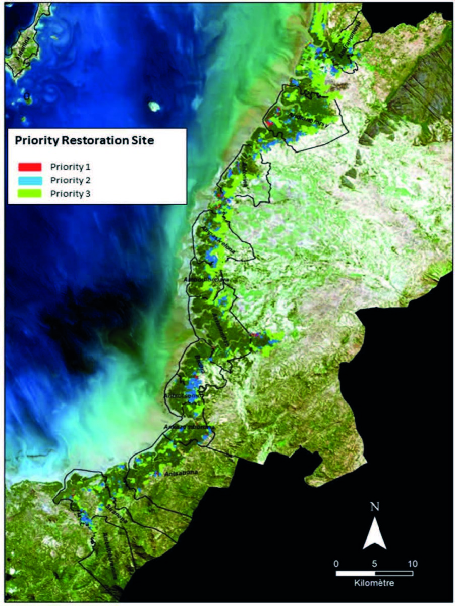
Results of the WWF Madagascar Use Case to analyse vulnerability of mangrove forest at Ambaro Bay.
Challenges
A major limitation to the implementation of the programme and the pace of work was intermittent and slow internet connectivity. This can severely compromise access to and acquisition of satellite data resources as well as access to the free, open-source analytical software on which the programme depends. Hand-to-hand sharing of datasets via portable disk drives helped overcome this issue, but this temporary solution is not compatible with the long-term sustainability and legacy of the programme. The age and computational capacity of available hardware, as well as the lack of up-to-date software versions, were also limiting.
In-country training was limited to the duration of visits by. implementing partners using training datasets. This did not always allow for in-depth road-testing of acquired skills with real data and adequate support. Necessarily remote and protracted training sessions in 2020, however, allowed participants time to apply their training between sessions while still being supervised.
When governments change, the leadership of key government partner agencies can also change. Building strong relationships with managers at lower levels within partner organisations was vital to re-establishing contacts with leadership following any restructuring.
Key lessons learnt
- The need for reliable data and the skills with which to use them is well recognised throughout the region, although the breadth of potential for the application of such data is underestimated. The creation of compelling narratives and the connection of earth observation data to clearly defined, policy-relevant questions can only help emphasise the value and benefits of existing data resources as well as promote the acquisition of valuable skills locally to harness those benefits. Showing how C-RISe data can complement data from other sources to resolve policy challenges can enhance their potential for impact.
- Engaging actors with knowledge of policy issues to ensure maximum impact is also paramount. Policy briefs are being compiled to further engage managers and politicians to expose and promote the range of issues that can be addressed by initiatives such as C-RISe, especially with the availability of data and improved local capacity to use them.
- Improved connectivity, communication and prolonged skill and information sharing within and between countries in the Southwest Indian Ocean offer significant benefits to the region’s overall prosperity and collective ability to address impending challenges.
Lead contacts
David Cotton, Satellite Oceanographic Consultants Ltd, (SatOC), Project Lead | E-mail
Amani Becker, National Oceanography Centre, Project Lead | E-mail
Download this case study (PDF)
View all Case Studies
Media contact
- Josephine Latu-Sanft Senior Communications Officer, Communications Division, Commonwealth Secretariat
- +44 20 7747 6476 | E-mail