The Commonwealth Secretariat has launched a discussion paper under the CommonSensing Project to enhance a nascent, yet important, conversation that is taking place around the world.

The Commonwealth Secretariat has launched a
Document
Earth Observation Discussion Paper.pdf
(946.32 KB)
Accessing climate finance is a significant challenge
Under the Paris Agreement,
Document
english_paris_agreement.pdf
(212 bytes)
The Commonwealth Secretariat has been working with member states to address the challenges that countries face in accessing climate finance. In 2015, the Commonwealth Climate Finance Access Hub (CCFAH) began helping countries translate their climate targets into action through the support of a Commonwealth National Climate Finance Adviser (CNCFA) able to leverage the lessons learnt in other countries through CCFAH’s ‘hub and spoke’ model.
In a
Document
201123-sids-final-report-ex-sum-top.pdf
(1.16 MB)
- constrained human resources to prepare applications,
- demanding application processes,
- unsustainable forms of short-term capacity building,
- and a lack of “historical local or national climatological data necessary to substantiate claims [for GCF] investments”.
Through the CCFAH, Fiji, Solomon Islands and Vanuatu have been able to work with CNCFAs to address some of these issues under the CommonSensing Project. The CNCFAs provide long-term technical assistance and human and institutional capacity building to improve access to finance.
However, the CommonSensing project is especially innovative through its use of Earth Observation (EO) data to generate the historical climatological data that enables countries to fully justify the impacts of climate change on their communities.
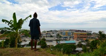
Satellites can provide robust data to justify the climate impacts on a country
EO data (a subset of Satellite Remote Sensing data) are typically images taken from space that capture observations of the Earth’s surface and atmosphere which can show the physical, chemical and biological systems of the planet.
The data generated can be used to provide rigorous, scientific evidence to support funding applications. The data can help decision makers to identify the right communities to participate in projects, identify boundaries of protected areas and help in pre- and post-disaster management.
The EO data has been collated in the CommonSensing platform and can be used for calculating baselines, reference conditions and measuring the rate of change of many environmental conditions such as temperature, sea level rise, flooding and land degradation.
Will this mean greater success in accessing finance?
With more evidence, national Governments can build stronger climate finance applications, which improve the chances of gaining access to funds.
Major climate funds, such as the Global Environment Facility (GEF) and GCF require strong justification and climate-focused rationale for approving project proposals.
These funds have been explicit about the role of EO in accessing their funds to different extents.
The
Document
The GCF has not produced explicit guidance on the use of EO data, but the GCF Independent Evaluation Unit has noted that they see weaknesses in proposals where there is poor quality baseline data. This might mean incomplete, inconsistent or unclear baseline information, such as in trying to calculate flood frequency and magnitude. We see that the application of EO data and technologies can fill these evidence gaps.
The time is now
The process of revising and implementing Nationally Determined Contributions (NDCs) provides a crucial window for developing countries like SIDS to take on the use of EO tools.
The Climate Change Section of the Commonwealth Secretariat hopes to contribute to the global discussion on how these digital tools can increase access to climate finance.
Join the conversation: read our new
Document
Earth Observation Discussion Paper.pdf
(946.32 KB)